
Walking a Flower Mound Street
Street-by-street research in Flower Mound begins with the parcel, not a presumed household list. The Denton Central Appraisal District, or DCAD, can connect an address to an owner or filing name, mailing address, situs address, legal description, and property ID. The situs is the physical taxable location. A mailing address is where correspondence is sent, and it may belong to an owner, agent, trust, or business elsewhere. The Town and county map viewers then place that parcel among roads, city limits, zoning, and other geographic layers. Those records establish an address trail, while a person’s current presence must be checked carefully and may not be public.
- Normalize the house number and street spelling with the Town’s Street Listing Index, which supplies address ranges, map grids, and subdivision context.
- Search the address or property ID in DCAD Property Search. Record the situs, mailing address, property ID or R number, lot or block, and legal description separately.
- Use the Town or county GIS map to pan the street, click the parcel, and compare city-limit, road, school, floodplain, and precinct layers. A parcel boundary is an approximate map feature until a recorded plat confirms it.
- Search the current owner as grantee in the Denton County Official Records Search, then match the instrument’s legal description before following a seller backward.
- Use the Texas My Voter Portal only to check an individual match where permitted, and use regional reverse directories or library collections for dated address clues. Neither source is a full street roster.
That order keeps unlike records from being blended together. An ownership record can be current yet point to a non-situs mailing address. A directory can place a telephone subscriber at an address for a particular year without proving later occupancy. Note: Keep the printed address, standardized address, parcel number, legal description, source date, and confidence level in one address timeline.
Flower Mound Street Names First
Before running an address search, test the Flower Mound street name against the Town index and the parcel’s legal description. The Town index is useful for address ranges, street names, map grids, subdivisions, and pickup-day orientation. It does not identify occupants. A recorded plat or deed describes the legal parcel, while an older newspaper or directory may preserve a rural route, a different postal city, or an earlier subdivision phase. Flower Mound’s growth and annexation context can put one household trail across county, Town, postal, or development labels without a move across the ground.
No official source located a Town-wide renumbering or street-renaming project with a definitive year. Do not assume a changed-looking address is the same parcel. Bridge it with a dated plat, the legal description, the parcel or R number, or County Clerk confirmation. Postal label changes, rural-to-subdivision development, and multi-town communities such as Canyon Falls are documented continuity hazards. A name is a search aid; a legal description is the stronger address anchor.
Flower Mound Parcel Search Fields
DCAD official guidance supports searching by owner name, address, or property ID. The exact current controls were not exposed in the inspected page, so these are the documented search routes rather than a promise of extra filters. The resulting parcel card is valuable because it keeps the mailing and situs fields apart. DCAD’s schema also identifies land and improvement fields, appraisal values, exemptions, year built, subdivision and lot information, and taxing districts. Its geometry and downloads update weekly, though owner data can lag during the annual notice and appraisal-review period.
| Documented field | How it is used by address | Important limit |
|---|---|---|
| Owner name, address, property ID | Search routes supported by DCAD guidance. | Exact live required-field rules were not captured. |
| Mailing and situs address | Separates correspondence from physical taxable location. | A mailing address is not proof of presence at the situs. |
| Legal description, subdivision, lot and block | Joins a parcel to a deed, plat, or changing street label. | Compare the full description before treating records as one parcel. |
| Property ID or R number | Provides a stable join between parcel maps and record notes. | Use the official record, not an inferred map boundary. |
| Values, improvements, year built, exemptions | Supplies assessment context for the parcel. | Confidential ownership and over-65 exemption fields are excluded from public downloads. |
The County Tax portal is a separate source. It distinguishes account number, owner name, owner mailing address, and property location, along with account type, active status, and paid-status choices. The difference matters: property location searches for the taxable situs; owner mailing address searches for correspondence. A tax result does not establish who currently lives on a street.
Flower Mound GIS Along a Street
The Town of Flower Mound GIS maps support public land-ownership, zoning, school, park, and trail views. For an address task, turn on the layer list, search or pan to the street, click the parcel, and copy its property ID and legal description. Denton County GIS adds parcels, landmarks, precincts, municipal boundaries, roads, floodplain, emergency service districts, and other public layers. The county’s described workflow activates parcel, address, owner, streets, city-limit, school, and sales layers, then clicks a parcel for the R number.
The Flower Mound GIS maps page shows the Town’s public mapping resources.
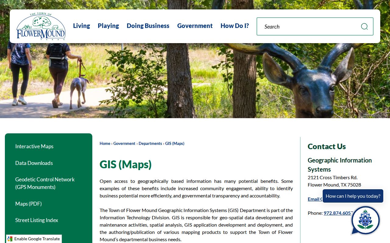
Use the viewer to orient a parcel and its jurisdiction, not to identify a household from a polygon. The Town says map data are approximate and do not replace a survey, so a nearby shape can be a common area, drainage tract, or road rather than an adjoining private parcel.
Flower Mound Records by Address
Several Denton County and Town systems can be searched by street-related data, but each answers a narrower question. DCAD supplies the appraisal snapshot. The Tax Office reports a tax account. GIS explains parcel geography. The County Clerk keeps recorded instruments. eTRAKiT presents municipal parcel and permit information. The voter tools are individual lookup routes and may display or suppress data under confidentiality rules. A reliable Flower Mound street-by-street result names the record type, date, and address key rather than collapsing those sources into a single claim.
| Address-keyed record | Custodian | Street-related evidence | Access and boundary |
|---|---|---|---|
| Appraisal parcel | DCAD | Owner or filing name, mailing and situs addresses, legal description, values, exemptions, improvements, and map ID. | Online property search; confidential fields have exclusions. |
| Tax account | Denton County Tax Office | Owner or address, account type, property location, and payment-status context. | Online tax search; coverage date is not stated. |
| Recorded deed or plat | Denton County Clerk | Grantor, grantee, instrument, recording date, liens or releases, and legal description. | Quick, Advanced, or OCR search; older deed microfilm begins in 1854. |
| Parcel map | Town and county GIS | Parcel shape, zoning, districts, floodplain, precinct, adjacent geography, and R number. | Public viewers with approximate boundaries. |
| Permit or code case | Flower Mound eTRAKiT and Town departments | Permit address, project, inspection, or selected case details. | Public search and request routes; historic depth is not stated. |
The shared join keys are the property ID or R number, full situs address, subdivision or phase, lot and block, and legal description. A person can appear in a deed under one form of a name, in a tax record under another, and in a municipal record with a different mailing contact. Preserve the printed form, then compare it in a separate note. Note: An online result without a date-range statement should not be treated as a complete historical index.
Flower Mound Deeds Along a Street
The Denton County Official Records Search provides Quick Search, Advanced Search, from and to recorded-date fields, quick date ranges, Index Only, and Index & Full Text or OCR modes. Its Quick Search placeholder allows a grantor or grantee, subdivision, document type, or document number. Start from a DCAD owner and legal description, find the deed where that owner is grantee, open the available instrument, and compare the lot, block, acreage, or legal description. Then use the prior seller as the next grantee in the backward chain.
The Denton County official-records interface displays its recorded-document search choices.
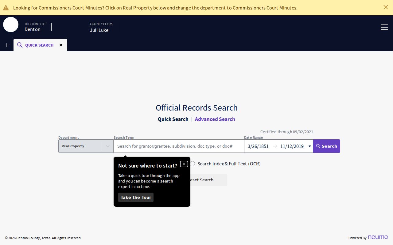
An instrument is stronger than an index line. Read the first page, acknowledgment, attached exhibit, and references to prior instruments when they are available. The County Clerk’s online cutoff is not stated, and the page’s certification notice should not be read as a coverage cutoff. The Texas State Library guide documents Denton deed records beginning in 1854 and notes missing or unfilmed volumes. County Clerk and microfilm work are the real alternatives when an older document is absent online.
Flower Mound Permits and Tax Clues
Flower Mound eTRAKiT searches Parcel Number, House Number, or Street Name with Equals, At Least, At Most, Begins With, and Contains operators. Its documented result tabs are Parcel Info, Owner Info, Restriction Details, Land Use, Building, Legal Desc, and Inspections. A permit can connect work and inspection history to a location, but it is a transaction record, not a current-resident register. The Town’s Building Information and Permits route and a Texas Public Information Act request are additional access channels when a needed municipal record is not visible in eTRAKiT.
The eTRAKiT parcel search illustrates the address, street, and parcel search controls.
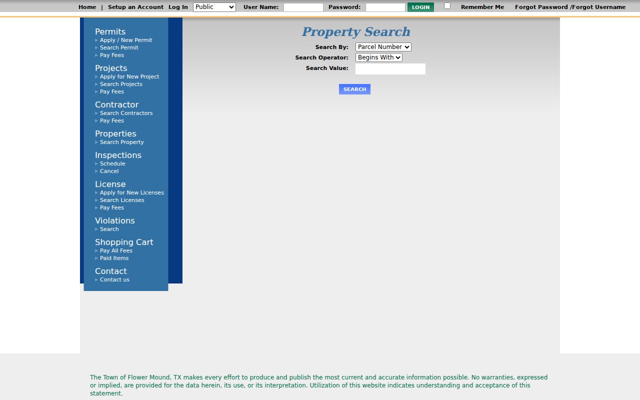
For tax context, use the Denton County online tax search and choose the appropriate owner or property-location route. Its visible choices include account number, owner name, owner mailing address, property location, account type, active status, and paid-status filters.
The Denton County tax-search page displays the search categories used to separate an owner mailing address from a property location.
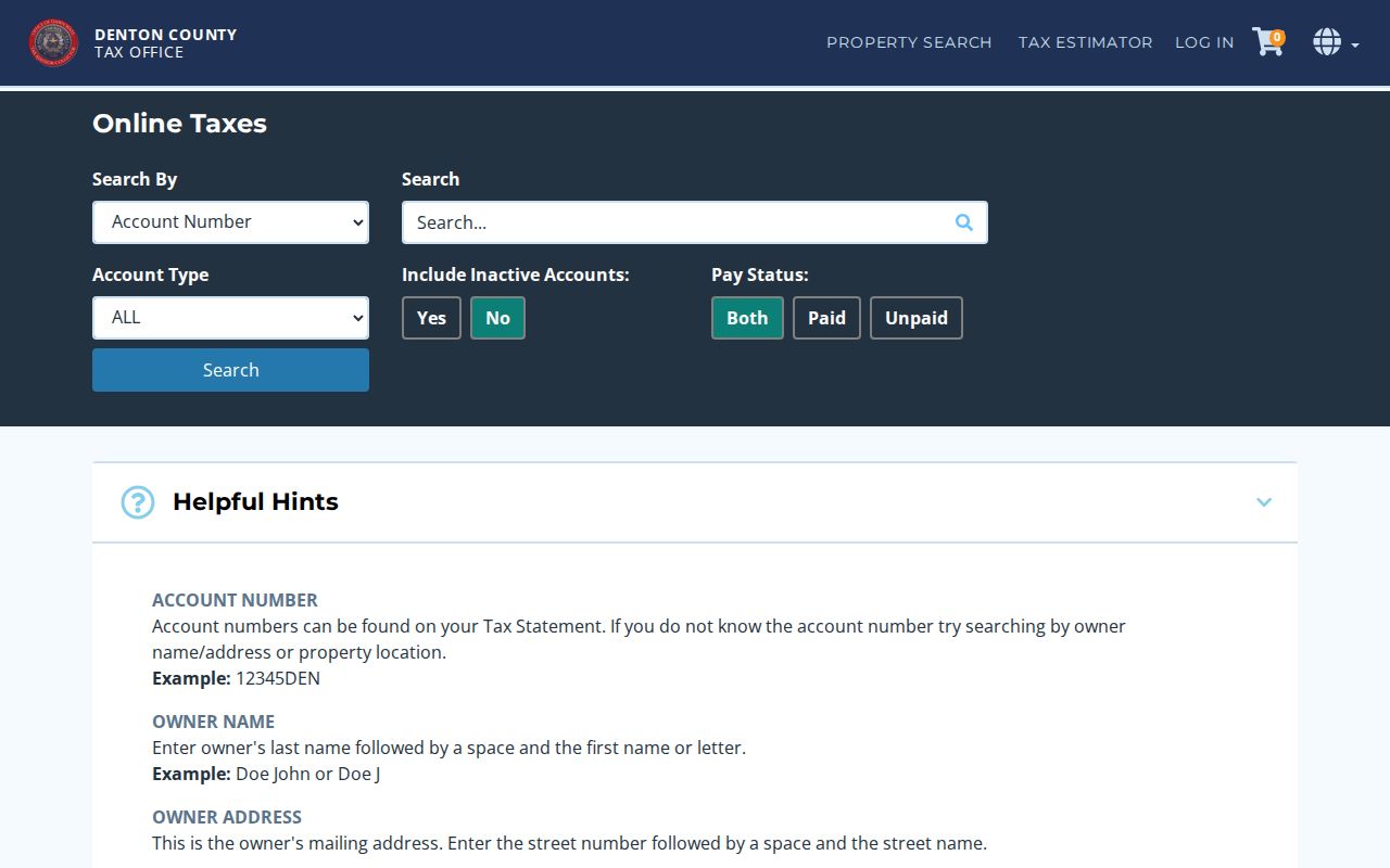
Tax status and balance information need care. They are account data, not a measure of character, and a tax account does not prove a person currently lives at the situs. If the exact document is unavailable online, identify the proper custodian, date range, and record identifier before making a Texas Public Information Act request. The Town’s current request channels are listed on its Open Records Requests page.
Flower Mound Voter Lookup Limits
The Texas My Voter Portal and Vote Denton are the documented individual lookup routes. The state workflow uses name, county, date of birth, and ZIP, with VUID or driver-license information available in some registration or update paths. A successful match may return status, residence or mailing address as permitted, polling place, districts, and election information. The web tool is not a public street-wide export and does not establish every person at an address.
Texas Election Code confidentiality rules protect certain identifiers and allow protected voters to have addresses suppressed or substituted. The County Elections Administrator is the offline route for a lawful request involving a current registration question, public list, historical poll book, or precinct statistic. The research did not locate the current bulk-file form, fee, delivery schedule, or a ZIP or street export mechanism. Treat participation history as a record of whether someone voted in listed elections, never how that person voted.
Flower Mound Street and ZIP Edges
A Flower Mound address can sit within a postal label that also serves Lewisville, Argyle, Northlake, Roanoke, or another nearby place. The Town map shows the area meeting ZIPs 75022, 75028, 75077, 76226, and 76262; USPS material also documents 75027 as a Flower Mound service or post-office-box label. ZIPs are delivery geography, not parcel lines. Check the Town map for municipal limits, Denton County GIS for county and precinct context, and the legal description for the parcel itself.
For a ZIP-focused task, use USPS to standardize the mailing address and ZIP+4 first. Then compare the Town and county maps, DCAD, eTRAKiT, and the recorded legal description. The Flower Mound ZIP code directory keeps that postal-boundary workflow separate from the street-level record chain. Note: A Flower Mound mailing label alone does not establish that a parcel is inside Town limits.
Flower Mound’s 1854 Deed Backstop
Denton County was organized in 1846, and the Texas State Library local guide documents county deed records beginning in 1854. That older record trail predates Flower Mound’s 1961 incorporation. It matters when a street search reaches land that was rural before subdivision development. The current online index does not publish an online start or cutoff date. A blank web search may therefore mean a reel, paper book, scanned image, variant legal description, or unfilmed volume must be checked rather than that no record exists.
The practical backstop is the Texas State Library Denton County records guide, the County Clerk, and the Office of History and Culture Research Room. The guide identifies direct and reverse indexes as well as missing or unfilmed volumes. For an older street address, retain the legal description and subdivision name before visiting or requesting a lookup. That gives the custodian a usable record key and avoids asking staff to reconstruct a person’s entire history.
Flower Mound Street History Clues
When the goal is an older address, use date-specific sources after the parcel work. Denton city directories are sporadic from 1920 through 1991, with the Denton Public Library collection stronger from the 1940s. Historical telephone books at the Office of History and Culture extend farther toward the 1920s in some holdings. A regional Greater Dallas volume can include a Flower Mound entry even though the title names another city. Entries can supply an address, telephone, name, occupation, or business context, but their scope and abbreviation key belong to that particular volume.
The Denton Record-Chronicle is on microfilm from 1909 through 2018, while digitized coverage has an approximate 1981 to 2002 gap. Library microfilm and local-history collections are the useful alternate channel for that period. Old directories and newspapers give a dated clue, not a permanent occupancy finding. A historical city-directory collection is covered in greater depth in the Flower Mound city directory.
What Flower Mound Street Records Leave Out
Public address records do not create a complete household list. They do not reveal utility-account holders, mail or delivery data, people absent from a public instrument, protected voter addresses, motor-vehicle addresses protected by the Driver’s Privacy Protection Act, sealed court matters, minor information, or confidential complaints. A map can identify a nearby parcel, but it cannot establish who shares a block face or who is present inside a home. A permit or code record describes an address and event, not a household.
- Parcel
- A defined piece of land used in county appraisal and mapping records, commonly tied to a property ID or R number.
- Situs address
- The physical taxable location of property. It can differ from an owner’s mailing address.
- Plat
- A recorded map that lays out a subdivision, lot, block, streets, and related legal geometry.
- Criss-cross directory
- An older reverse-style directory organized by address so a dated entry can be compared with a name section.
Lawful use. Use Flower Mound street records for personal, lawful research and keep sensitive facts to the minimum needed. Texas Penal Code §§42.07 and 42.072 address harassment and stalking; do not use an address trail to stalk, harass, intimidate, or harm anyone.